Wednesday, January 29, 2020

Whitewater Draw Weekend

With Winter firmly ahold of us (temps in the 60s!), it was time to plan a birding trip to Whitewater draw. I've posted about our many trips there a couple times a year for nearly a decade since we discovered it. In recent years, Arizona Game and Fish have installed a webcam to keep an eye (and ear!) on the action there. This year showed a LOT more water than in the last few years. I'm not sure it is from more rainfall or if the irrigation system is working again after failing a few years back. It sort of put a crimp on the cranes the last few years, so was looking forward to seeing the place again.

I ended up going out both Saturday AND Sunday! There were lots of cranes, but interestingly, they were all avoiding the water! Years past they all gathered in the shallow water to avoid predators (coyotes) through the night, but now they gathered on the banks. But this behavior brought them closer to the walking path, so was able to get some good close-ups.

The main activity besides resting (feeding is generally done in fields away from the wetlands), as well as male posing, presumably looking for females, or exerting dominance. The pair of males shown here were trying to out-do each other. I was in the perfect spot for the photo at left where they were standing tall with wings outstretched - mirroring each other. The left image is a full-resolution blowup to show the steely gaze of the crane looking my way.


It so happened that I was set up next to 2 other photographers - all of us shooting with the same setup - Canon cameras with the 500mm and 1.4X extender! I was the only local one. Anyway, the two cranes continued their antics shown here. At right, one went low the other high, and finally at right it appears the confrontation was over. I wasn't sure which one won the contest, but I'm sure that THEY did!

The group of cranes adjacent to the walking path was closest to us, but was small in numbers compared to the main group which seemed to the west side of the wetlands, about a quarter mile or so away. They were raising quite a racket out there, and in binoculars, seemed again to be avoiding the water. Some snow geese were, as usual, scattered among the sand hill cranes.

I love their rattling calls. If you tune in to the webcam above, you can hear them. On occasion when something causes them to take to the air, the show starts when you hear the wing beats of thousands of cranes taking to the air, then the ruckus starts with the calls also filling the air. I can sit and watch/listen for hours, which I generally do - occasionally taking a photo or two!

At left, the view is towards the west - the large groups of cranes can be seen at bottom, with many taken to the air, seen in silhouette against the Mule Mountains. The lowlands contain fields where the cranes often congregate.  At right is a view to the northwest, again seen against the mountains illuminated by a very low sun.

As has happened a few times in the past, as sunset neared, there appeared a "tornado" of blackbirds, rushing in huge groups to congregate in the reeds and rushes around open water. Upon closer examination, they were, in fact, yellow-headed blackbirds. At left they are seen as they gather, with cranes in the background. They are evidently close cousins of the more common redwing blackbirds, but Whitewater is the only place I've seen the yellow-headed version.

There were many other species of birds feeding. Here at right are seen a group of American coots taking one last feeding trip across the wetlands before it got dark. Only seen in silhouette here, they sport nearly white beaks and dark red eyes, making them more striking in full sunlight...


I had spotted a great blue heron as we entered from the parking lot, and right on cue at sunset, it flew right in front of me to roost in a clump of vegetation not 50 yards away. In the deepening twilight, the exposure was long enough that the wing flaps were blurred, but in scanning to follow it, at least the pupil of the eye is still sharp!

The usual routine was for the cranes to return to the protection of the water as nightfall came. Many took to the air and flew nearby, and it is always a challenge to capture them against the twilight sky. At right is about my best effort as they were gliding without flapping their wings. Even as it got dark they were sharply captured.


I'll have to say, that Saturday's twilight was likely the most spectacular I've ever seen! Of course, there are a lot of those in AZ, but this one was very long-lasting, actually 45 minutes of color from looking at the time stamp on my images. I've got 2 to show here, at left a single image showing some of the birders here distracted by the sunset colors. And at left is a 3-image "HDR" (High Dynamic Range) photo that combines different exposures to extend the visibility of highlights and shadows...


It was clear enough on Sunday to take a few
star photos.  The big news in astronomy now is that in the constellation of Orion, the upper left star, Betelgeuse has been growing fainter than it has ever been seen!  Instead of the brightest star in the prominent constellation, it is now third-brightest, effectively tied with Bellatrix, the upper right star.  At left I took a photo purposely out of focus to show the colors of the striking constellation.  The orange color of Betelgeuse reveals it to be a red giant star - very cool (thus orange-colored) compared to the bluish other stars of the constellation.  At right is another not quite as far out of focus to show much fainter star colors.  While most are still blue, many fainter ones have reddish colors as well.

I've only started to harvest images from these 2 trips, so look for more soon, as well as likely more trips while the cranes are here!


Wednesday, January 15, 2020

Return Trip

Jeez, my return to AZ was nearly 2 weeks ago - probably overdue to post about it! It started with what is getting to be a tradition - meeting my sister Linda and her husband Lauren to hunt for eagles along the Mississippi! Clinton, IA (where I was born) has a bald eagle festival the first weekend of January. On most years, the Mississippi is iced over and eagles gather below lock and dam #13 where the open water allows fishing. When that occurs, you can see hundreds of bald eagles in the trees along the river, occasionally taking flight and hunting fish. Both last year and this, there was no ice (temps in the 60s, which we enjoyed on Christmas will do that!), so we had to go hunting for what used to be a rare sighting of eagles. Back 50 years ago growing up in the area, we never saw eagles, but they are quite common now.

But we did have a couple brisk nights with temps in the low 20s, and some strong winds, and as we went exploring along the eastern shore of "Lake Clinton" above the dam, we saw some cool sightings of the shore, plants and rocks with a translucent coating of ice, melting in the late-afternoon sun. These were taken at "Thompson Slough" where there was a nice-looking campground that my sister's family had stayed a number of times.

It was quite striking, both the ice coating around the water line, as well as the water itself - there was enough wave action that random "puzzle pieces" in the water moved up and down relative to each other with an edge of slushy ice along the border, as shown at left. With the moderate temperatures, the ice likely didn't hang around long...


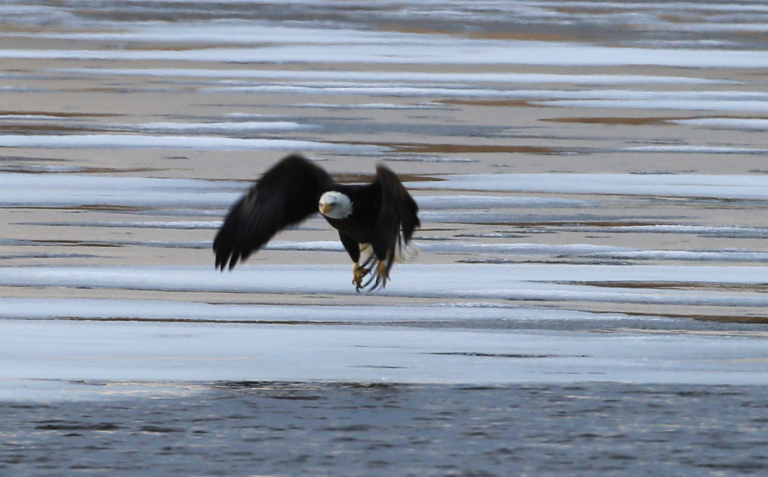
So the search for eagles continued.  Last year we had success up near Sabula - another 10 miles upstream on the Iowa side. One of my favorite aunts lived in the area until a few years ago, and there was little excuse to visit the area any more! Anyway, there is a little city park on the south side of "Sabula Lake", and as we headed there, sure enough, there were a couple eagles standing atop some thin ice on the still water... As shown at left, these were the only eagles we spotted on New Year's Day. With the river open, it was NOT fishing as normal with them hanging out in the trees along the river. These photos were taken in the very-late afternoon (about 30 minutes before sunset) with a big, 500mm telephoto lens. We were not very close to this pair (perhaps 100 yards or more), but the following close-ups are shown at full-resolution. The closer of the eagles took off just as I was setting up on it, so got a quick sequence of it jumping into the air...


After the first hop upwards above, the first wing flap appears to have bounced off the ice, as shown at left. By the next stroke at right he was truly airborne and on his way. I should have cranked up the gain (ISO) on the camera in the growing gloom, but the longish exposures had subsequent images blur unacceptably...

We scurried back down to Fulton (across the Mississippi from Clinton), and met some family for dinner at Manny's - a pizza and sandwich place of some renown. All the siblings save baby sister Sheri, now in Alabama, were there, as was my Uncle John and his family, including his son who was visiting from the Boston area - a real family reunion!

Already to the Mississippi, I headed towards AZ from there. I made it to Des Moines that night, then drove all day down across Kansas, Oklahoma, Texas into New Mexico staying at Tucumcari the second night. Didn't take any photos for much of the trip, but a striking sight from even 100 miles away was the San Francisco Peaks welcoming me back to AZ - the remnant of an ancient volcano and at 14,000+ feet the highest point in the state. Here I was still 30 miles east of Flagstaff (and the mountain), but even from that distance it was an impressive view! So the trip was uneventful, short at 12 days away, but still very glad I did it!


Monday, January 6, 2020

Mr October!

When I was back at "Ketelsen East" during the Fall, while out enjoying breakfast with Melinda's buddy Sallie, I happened to notice a copy of the St Charles Daily Herald open for restaurant patrons to enjoy. I noticed there was a "calendar contest" for local residents, with a deadline towards the end of October. Never having even seeing a copy of the paper or previous calendars, I wasn't sure what sort of images they were looking for, but the blurb said they wanted "photos illustrating life in the Northwest and West suburbs".


Well, I had a couple favorite macro subjects and submitted them the night of the deadline. They said winners would be contacted by December 6th. Not expecting much from the special-interest macro images, I waited...


But miracles of miracles, I got an email from "Kat" from the paper stating I'd won! No details, but my "prize" was a copy of the calendar and while their subscribers got theirs in the Sunday, 17 December edition, they wanted to send me a copy. Since I was in Tucson, they mailed it here. I suspect it passed me as I was driving back to the Midwest this recent trip. But it was waiting for me upon my return yesterday! I'm Mr October, and my alternate submission was in the last page of "honorable mentions"!


The "dewdrop on Dandelion" is likely my favorite image of all time, so was hoping that was the one chosen, and indeed it was, though I had an early indication the alternate - "Aphid on Dandelion" was the one they were using. Interesting that both are of dandelions, yet, I've not seen any around the house(the camp might be spraying, or perhaps because of the Fox flooding the last couple years) the last few years... The "dewdrops" were taken in November of 2016, and the aphid in May of 2015... No, I do NOT know how you can get a copy of the calendar, since they were distributed free to subscribers. But for your viewing convenience, I include copies of the winning images here. 


So I had a nice holiday surprise, but didn't get rich from it! Although they did spell my name right! Got to be thankful for that!

Monday, December 30, 2019

Another Window Seat

Truth be told, I never PLAN to have blog posts come out only every 5 weeks - that is just the way it turns out! I still have plenty of explorations to write about, it is just that I lack inspiration and hours in the day it seems...

So am trying to get back into the habit. While generally a post with this title indicates another cross-country trip sitting beside an airplane window! Well the first part of the statement is true, but this time the trip was from the 'ole van, and pics were taken from behind the wheel. It really isn't a dangerous undertaking - these photos are split between the cell phone and my Canon 6D - easy enough to point and shoot in auto mode with a minimum of aiming, or taking eyes off the road. Anyway, I hope you enjoy the story of the trip!

The reason for the drive was 2-fold. First, I HATE trying to fly near the holidays. The trips are expensive and jam-packed, and heaven forbid if there is bad weather, it might be days to get to your destination! I dislike the cattle-car packing of the flights these days, and consider myself fortunate for an empty seat near me, but it won't happen near Thanksgiving or Christmas. The other reason for the drive was that I had a payload - I'm packing up another telescope to the Midwest and returning one to Tucson to sell - as well as toting a refrigerator! The fridge in St Charles has been acting up a little - compressor ALWAYS seems to be running, though still cold, but the appliance repairman said there was nothing to be done - newer models aren't designed to be worked on. A couple weeks before my trip, my friend Susan near Cornville, AZ indicated the fridge she got when she bought her house worked fine, and had a water and ice dispenser - but was a side-by-side, which she didn't care for, so she made me a gonga deal, and it was out of her garage! Her big, strong housemate helped me load it (shown at left), and 3 days before Christmas (Sunday, 22 December), I was on the road!


The weather was great, no systems moving through, so looked to be clear sailing for the 25 hours of driving. The plan was to stop somewhere near the halfway point and break it into 2 days. The first opportunity to stretch my legs was about 90 minutes after my start as I passed Meteor Crater! No plans to visit the big hole itself, but it never fails to amaze me to pick out the raised rim crater from nearly 20 miles away! I pulled off the interstate for a photo, and at right, the shot is from nearly 5 miles distance. Go here for some other posts and shots of the crater itself...


Back on the road, I soon ventured into new territory! While I'd been to Meteor Crater a good 3 or 4 times, a few miles beyond at Winslow, was new countryside. From southern AZ, I'd always gone east on I-10 to Las Cruces and diagonal across New Mexico on highway 54, so I finally got to see northern AZ to Albuquerque along I-40.  It was quite scenic heading into Navajo lands, with spectacular landforms lining both sides of the highway. I should have done a little studying before hand to learn more about the area. Of course too, it would likely have paid to not be in such a hurry, with time to visit the Petrified Forest National Park, and the Chaco Culture Historical Park, which my friend Margie has been bugging me to visit for a decade if not more... At left is some of the landforms along I-40 while still in AZ, and at right are hills and mountains near Grants, New Mexico, including the snow cap of Mount Taylor, at over 11,000 feet elevation. And if Grants sounds familiar, we flew over it a few months ago on my last trip to the Midwest - the funky landforms helping me locate the town of Grants on Google Maps! This time I drove around that same funky plateau, seen in the photo I had taken here.


A few hours later and I was coming into Albuquerque - approaching it from the west. I had passed through before from the south, again heading east on I-40, so was back on familiar ground. This time, however, I've seen the complete story arc of "Breaking Bad", which was supposedly filmed in the Albuquerque area, so was interesting to see some of the area, even driving at 60+mph! At left I'm descending down into the valley with an inversion layer over the city with the Sandia mountains forming the eastern limit to Albuquerque expansion... Nothing but a bathroom break there, but proceeded past Santa Rosa on to Tucumcari for another potty and snack break. I was into Texas for the sunset and managed to get the twilight glow in the rear view mirror while looking out upon a farm of windmills... I was hoping to spot "Cadillac Ranch", an art piece out in the middle of a field that we blogged about on one of our earliest posts. How can you miss it - 10 Cadillacs buried nose down, where you are invited to invest in spray paint and "make it your own"! But I missed it in the dark...

I made it to the western edge of Oklahoma City, where I figured the halfway point was located. Calling ahead after a smartphone search, found a Motel6 with reasonable rates an hour before arrival, and crashed for the night...

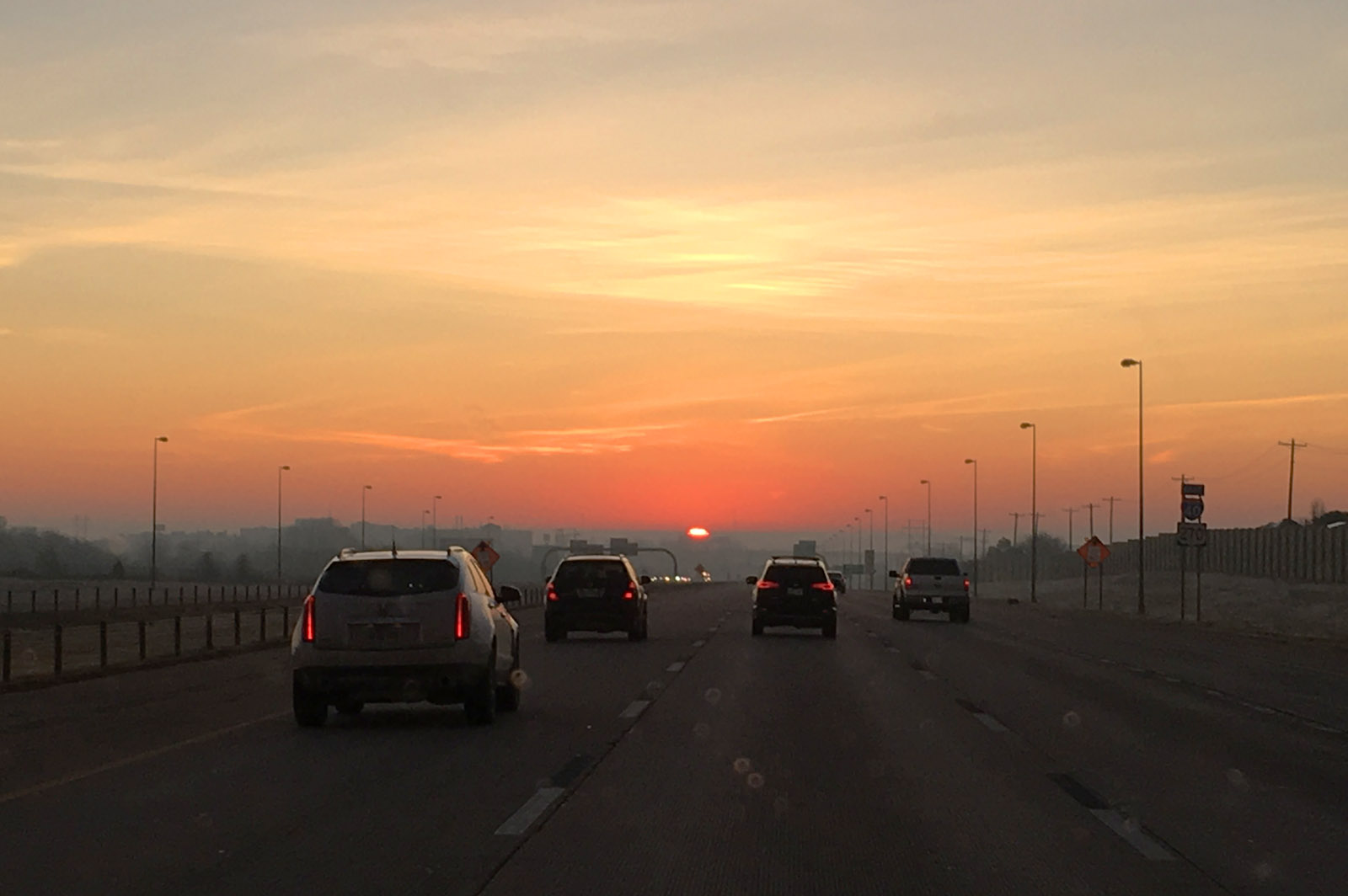
Sleeping well, I woke relatively early and packed well before sunrise, but paused for a pretty view of the waning crescent moon in the twilight sky over the frosty van after the chilly night. It was cool and humid enough there was considerable fog in the area. Eventually the sun rose up through the fog layer and made for a spectacular sunrise - right in my face, of course! But there were periods where the visibility dropped to almost zero in some locations, but eventually the rising sun burned it off...


The second day was mostly a blur. Moving diagonally across Oklahoma on I-44, then across Missouri towards St Louis. Stopped twice for gas and a time or two for bathroom and snack breaks. The only photogenic shots were approaching the Mississippi River bridge on the bypass around the south side of St Louis (have never tried going through that city). Being later in the day, 2 days before Christmas, traffic was already bad and I didn't want to risk trying to go through it this time! Along the bypass, there is always a good view of the distant skyline and the Gateway Arch. Have always wanted to visit it with Melinda, who grew up in the area and remembers it being built. Some day, but missed my chance to make the trip with her!

The trip across Illinois was uneventful - up I-55 to I-39 until we got closer to the Fox River Valley. Pulled into my Jewel store for some groceries about 7pm, which was just jammed with holiday shoppers, and pulled into the driveway about 8pm.  Wasn't long and the heat was on and the place was homey again... Hope you had/are having a great holiday season!

Friday, November 22, 2019

Look to the Skies!

It seems to have been a while since we've had a good planet grouping in the evening sky, but the current show is starting now! While Jupiter and Saturn have been in the evening sky for a few months, they are slowly retreating towards the Sun as the Earth's more rapid motion appears to move them to the far side of the solar system. Meanwhile, Venus has leapt from behind the sun (again, its motion is more rapid than the Earth), and is about to join the other pair in the early evening. Tonight Venus was still well below Jupiter, but tomorrow (Saturday, 23 November) will approach within 1.5 degrees (3 moon-diameters), making a striking sight! Next week, on Thanksgiving night, the crescent moon joins the grouping, and finally on 10 December, Venus passes Saturn and the conjunction show will end for now. Here is how they looked tonight (Friday, 22 November) from near Cornville, AZ. The planets are about to set behind the Mingus Mountains, with the lights of Cottonwood, AZ in the foreground. In the labeled image at right, you can also see the "teapot" asterism of Sagittarius as it also moves behind the sun for the season.

Catch the show while you can!

Thursday, November 14, 2019

The Window Seat!

It was a week ago now that I transitioned back to "Ketelsen West". The move was just in time evidently as the high temperatures back east are in the teens and single digits, and Tucson is warm (80s) and sunny. But I enjoy both locations, so pretty much am home at either location.

As always, I enjoy the plane ride and always book the window seat - looking down sun, of course! Having the sun shine into the window you are sitting creates bad reflections and makes for lousy photos. Always shooting down sun is the way to go. So for the morning flight, I was on the right side of the plane, scoping out the northern direction from our flight path.

We had full overcast, but not the predicted freezing rain as we took off. It made for a boring start to the flight other than what was seen as soon as we cleared the cloud deck - a glory! Now these are not unusual - I've even blogged about them a couple times before. In this last link, I even demonstrated that you can infer the cloud droplet diameters by measuring the diameter of the first ring of the glory. You can also tell from the centering of the rings that I was sitting at the rear of the plane. Everyone who looks has their own - the pilot in the front sees one centered on the front tip of the plane.

The clouds hung around thru all of Illinois, and it magically cleared showing the Mississippi and the "Quad Cities".  Shown at right, is the River, with Davenport above it, Bettendorf to the right, Rock Island in the middle of the River and Moline below. Below Moline is the regional airport I've flown out of a few times when visiting family back in the 90s.

The little game I play is to see how far I can keep track of our flight path. Of course, rarely we fly over my house or family farms I've spend my early years tending. When/if I get disoriented, take a photo of a distinctive landmark you can find on Google Maps and re-set the internal clock - even when after the flight! For a little ways we paralleled the Mississippi until it turned more south, and shortly after that I spotted the confluence of what must be the Iowa and Cedar Rivers in SE Iowa. I also had my IR camera at the ready which much more readily shows the streams and wetland areas as pure black at a much higher contrast. Here the color shot is at left and the infrared version (beyond our range of vision to the red at right. I purposely used the wider view for the IR since with its additional property of haze-cutting, it also shows details at greater distance too. In the color shot, you can spot the towns of Columbus Junction to the left of the confluence, and Fredonia to the right. Just above the confluence is a huge Tyson Foods processing plant...


Crossing southern Iowa wasn't particularly exciting - no major metropolitan areas. There are a couple big reservoirs which served as waypoints as we crossed hundreds of miles of farm land. The next BIG appearance was the Missouri River. The Missouri has seen some major flooding in recent years and I've not kept up with its current status. In the visible image at left, the main channel seems full and perhaps some nearby farmland appears flooded. What I noticed in taking the photo is there was a loop-de-loop in the center, and a cursory search revealed it to be an "oxbow" lake, where the meandering of the river got cut off, forming the characteristic shape lake. This particular one is called Big Lake Recreation area, about 25 miles northwest of St Joseph, Missouri. If it can be believed, the area looks even more impressive in the IR as shown at right. With the plethora of darkness, there might be much more flooding down along the Missouri that I first realized...


Once into the northern Kansas area, all bets were off as far as keeping track of the flight path.  At least off the right side of the plane, there were no metropolitan areas - only the occasional reservoir allowed checking the flight path later.

There is another interesting optical phenomenon seen when looking down sun. When very high (we were at 32,000 feet), where the plane's shadow would normally be, you see a subtle bright spot instead! Called the Opposition Effect, it is an enhanced brightness as there is a small area without shadows, and possible brightening depending on what type of surface it is. I was waiting for this brightening to pass over a town or urban area, and it finally did - over Lacrosse, KS. Shown at left, the diffuse bright spot is tough to pick out, but what it does do is make all the street signs glow brightly! You can see many of the signs along the main drags brightly colored as the glass balls built into the signs to enhance brightness at night also work to reflect the light back to the observer during the day (me, in this case, the shadow being cast on the town)...

At the western edge of Kansas, dropping into Colorado and New Mexico, the clouds increased and there was nothing more to see. I missed the normal sight of Albuquerque, the VLA Telescope, and Mount Graham as we approached Tucson - all lost in the clouds. It didn't really clear till we crossed the Rincons on the east side of Tucson. Circling the town once, to land towards the southeast, we flew pretty much right over my house, so got a good view of the Rillito Racetrack - a horse racing venue during late winter about a mile north of my house. Also seen on the image to the left is the bike paths that trace both sides of the Rillito wash where I bike all the time.

Continuing to circle, we had a view to the west also, where a distant view of Kitt Peak (the flat-topped mountain in the far distance) was seen over the nearby Tucson Mountains.

Another journey complete, but I'll guarantee you that next trip I'll be watching out the window yet again!

Wednesday, October 30, 2019

Colorful Coin

Under the category of "what the heck is that" is this coin I received in change the other day... The front side (left) is normal, but the back is in color! I didn't think much of it, figured someone was doodling with fingernail polish, and didn't think much of it. I finally dug it out of my change jar yesterday and took a good look at the obverse side. Shown at right, it appears someone took cares to color at least part of the design - trying to stay inside the lines, anyway... I took out my "supermacro" (Canon MP-E 65mm) to document here. The upper images here are at the lowest magnification I can get - about 1:1, or life-size on the sensor. The quarter just quite does not fit in the field of view. But even here you can see that the scene isn't a straight painting, rather it appears to be a multi-layer screen print. Note the screen dots on the details of the woman and what she is carrying - indicative of some sort of a screening or printing procedure.

I was not aware that this was a "thing", but a quick internet search showed them available at Amazon and Ebay for as little as $2 each when bought as a complete set. They appear to be legal tender, which is likely how I received it, when someone needed a quarter and spent this for whatever purchase was needed...

The close-ups here were taken with the same lens at about 3X magnification (scale at bottom is in millimeters. Note especially on the "Pennsylvania" detail, there appears to be a slight registration error of about a half millimeter. At right you can also see the barely-visible E Pluribus Unum through the layer of color at bottom...

All-in-all, an interesting circumstance to run into this item. They do not appear to be common, as after posting last night on FB, most have indicated they've never seen one! One fellow knew someone that collected them, but were new to another half dozen commenters. But they are out there and another reason to pay attention to your money!